The Isovist_App is a free multi-platform software tool. It has been designed as an intuitive interface to advance the learning and adoption of spatial analysis techniques at all levels, from undergraduate learning, to advanced research, and in design practice. It is based upon the spatial unit known as the ‘isovist’, defined as the finite volume of space that is visible at any given point at which a perceiver might exist (Benedikt, 1979).
Every isovist has formal properties (such as size, shape, and so forth), as well as a set of relations to all other isovists within a space. Such properties and relations can be quantified—“measured”—and the (usually changing) values of these measures can be mapped through the entire space (all points) to create fields. The Isovist_App does so quickly and efficiently, in high-definition, using easily prepared plans or sections. As such it provides an alternative to traditional but computationally lengthy ‘visibility graph analysis’ methods (Turner, 2001a & b), at resolutions that negate concerns of spatial grid definition associated with such work.
The measures and fields generated by the Isovist_App have been developed from the isovist literature based on Benedikt’s 1979 paper, as well as from ‘Space Syntax’ literature based on the work of Bill Hillier and Julienne Hanson. The two literatures overlap, conceptually and in application. Isovist work tends to focus on buildings, interiors, and on human social and aesthetic experience and perception, whilst Space Syntax tends to focus on the city, behaviour and configurative aspects of space. The Isovist_App can be operated at any scale, from single rooms to urban street patterns, and so aims to be useful to both areas of interest.
Results from the Isovist_App can be output as high-resolution coloured pdfs, or as numeric point data. Such information allows intuitive and empirical exploration of experiential, navigational or socially significant affordances within existing or proposed spatial structures. Our aim is to help students, architects, designers and researchers to better understand the built environment and how people might respond to it.
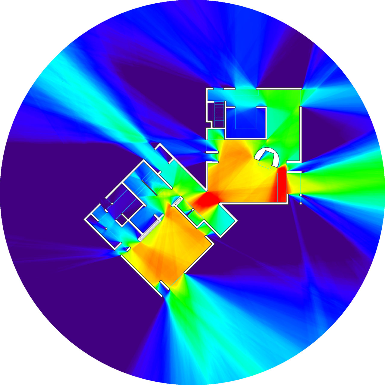
Below: Expanded visibility fields in Kahn’s Fisher House.